
Map Your Park
A web design that allows users to explore, connect and share national parks experiences
Duration - 2 months Team of 1 Role - Designer, Developer

Project Brief
"Map Your Park" is an informative and social platform designed to enhance National Parks travel experiences. With the core value "Connect People and Nature", Google Map, National Parks Service, Flickr and other information are integrated to provide better web experience for national parks information.
Enter Here-> Map Your Park Site
Vision
The main spirit behind "Map Your Park" is to "Connect People and Nature". National parks are important for natural, cultural and historical preservation of the country while social media can bridge stories from different people and locations.
Thus, in this project, I hope to connect people to the beauty of nature through
- Explore national parks on an interactive map
- Connect to information and stories about parks
- Share personal stories of traveling to national parks
Design Process
The purpose of this design is to combine and improve on existing digital artifacts, while also create broader value on top of my design concepts. Thus, it is both important to create innovative solutions and follow digital design conventions to lower barriers for entry.
During the design process, I investigated existing national-parks-related resources, conducted a competitive analysis to identify design opportunity, and implemented design iteratively based on user feedback.
Background Research
01 Investigate other artifacts
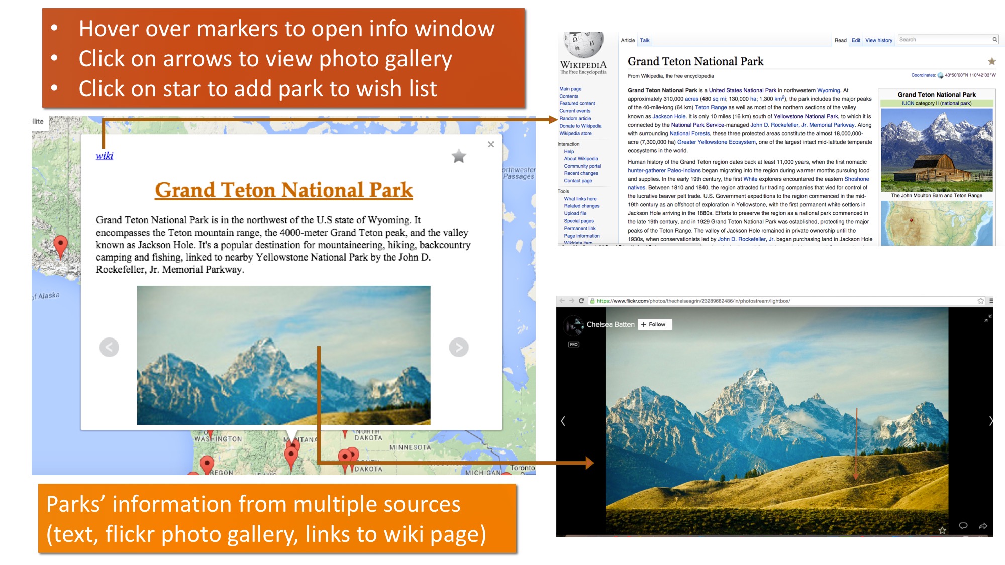
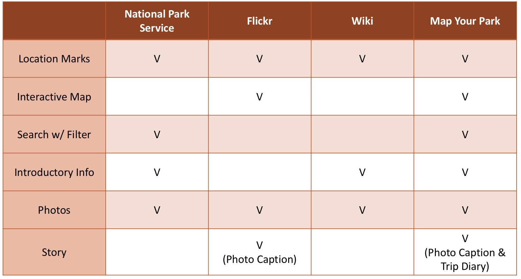
National Park Service, Wikipedia and Flickr provide different parts of national parks' information, including feature description, geographic information and photographs, which I want to integrate and redesign.
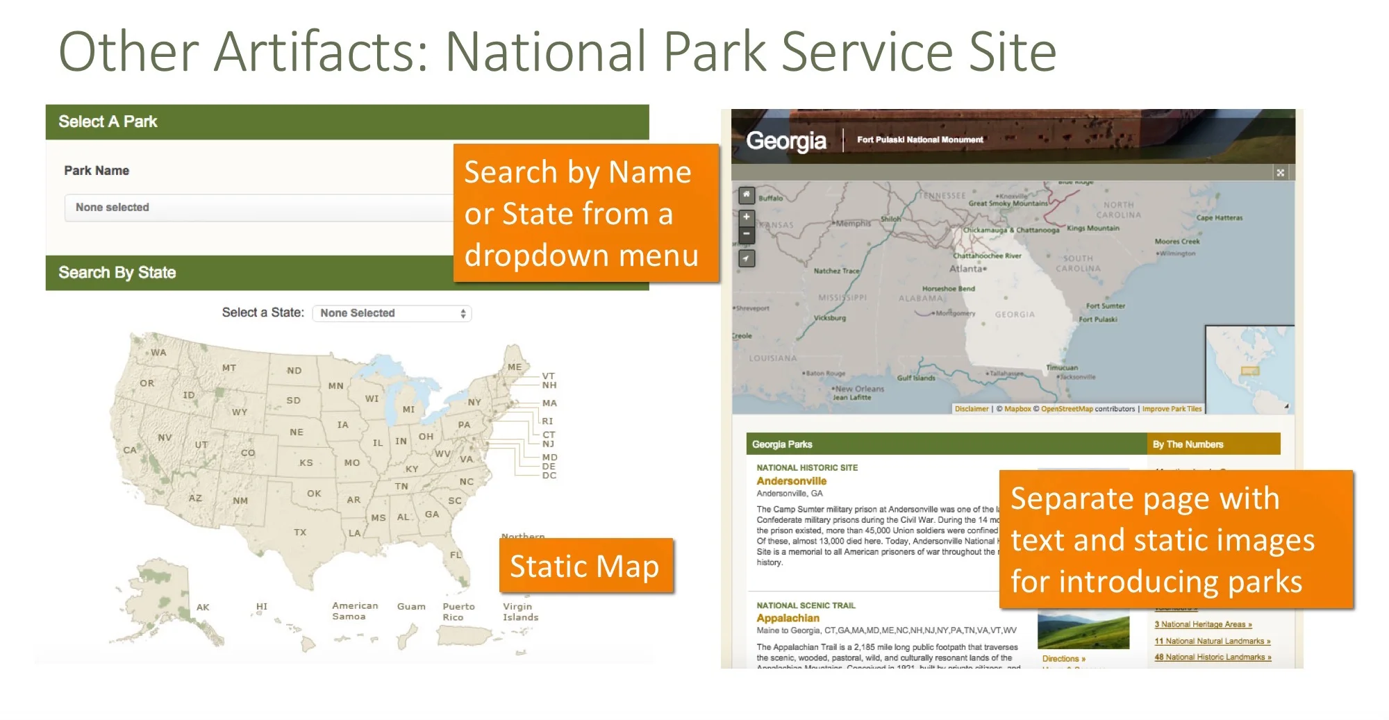
National Park Service
Show national parks in a static map and a drop-down menu
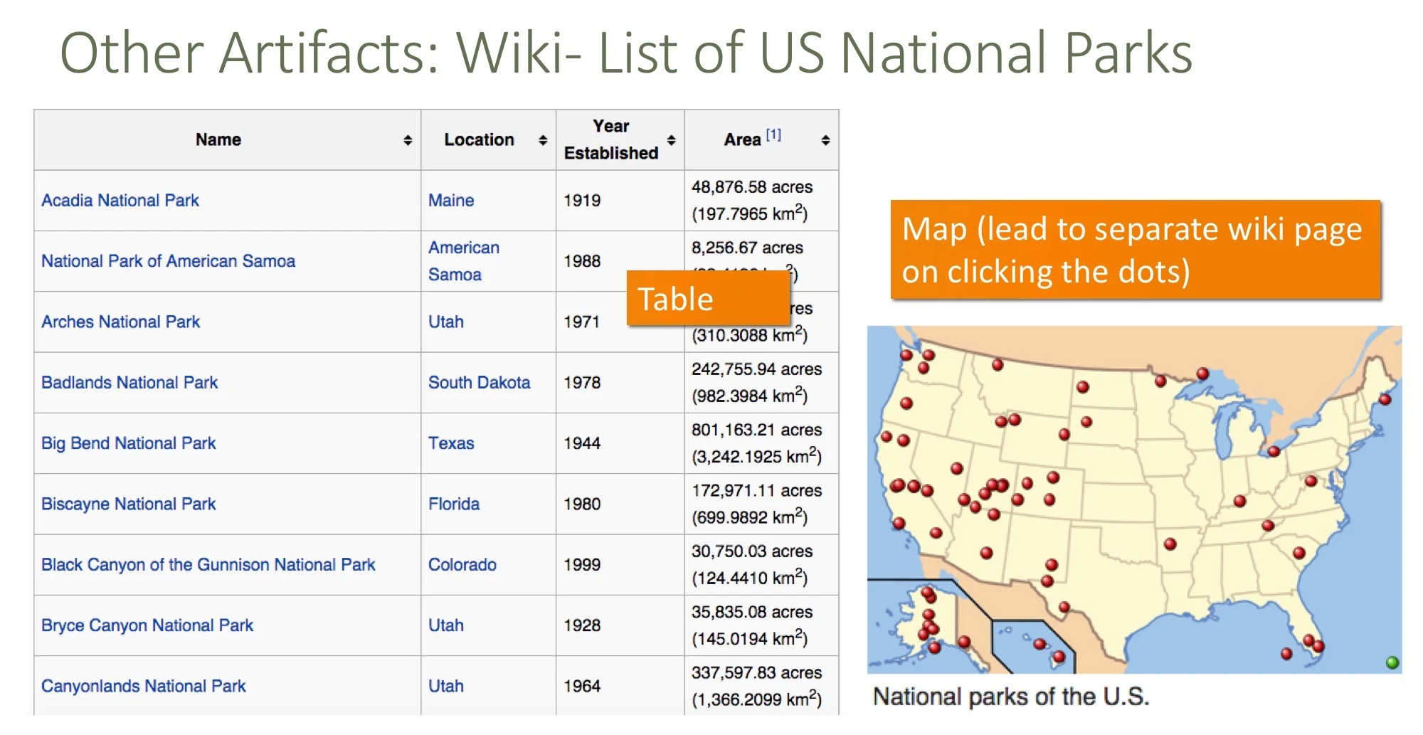
Wiki
Show information in a list and a static map
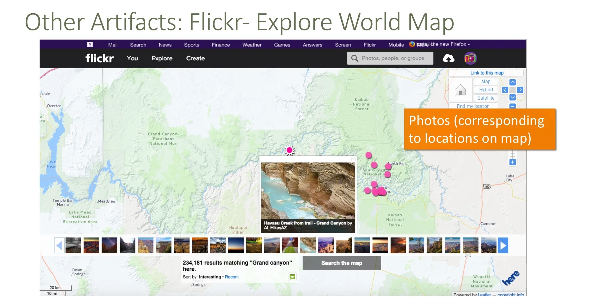
Flickr
Photos are marked on the map based on locations
02 Design Features and Interaction Conventions
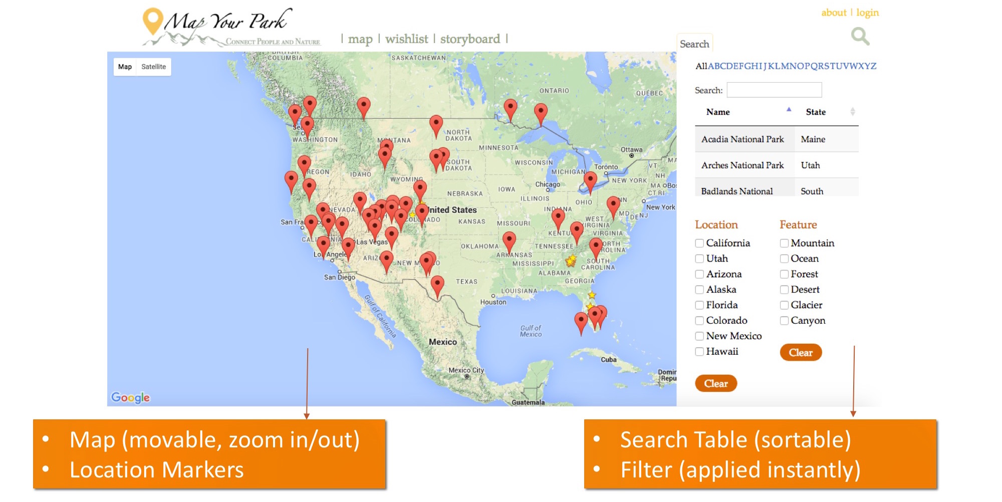
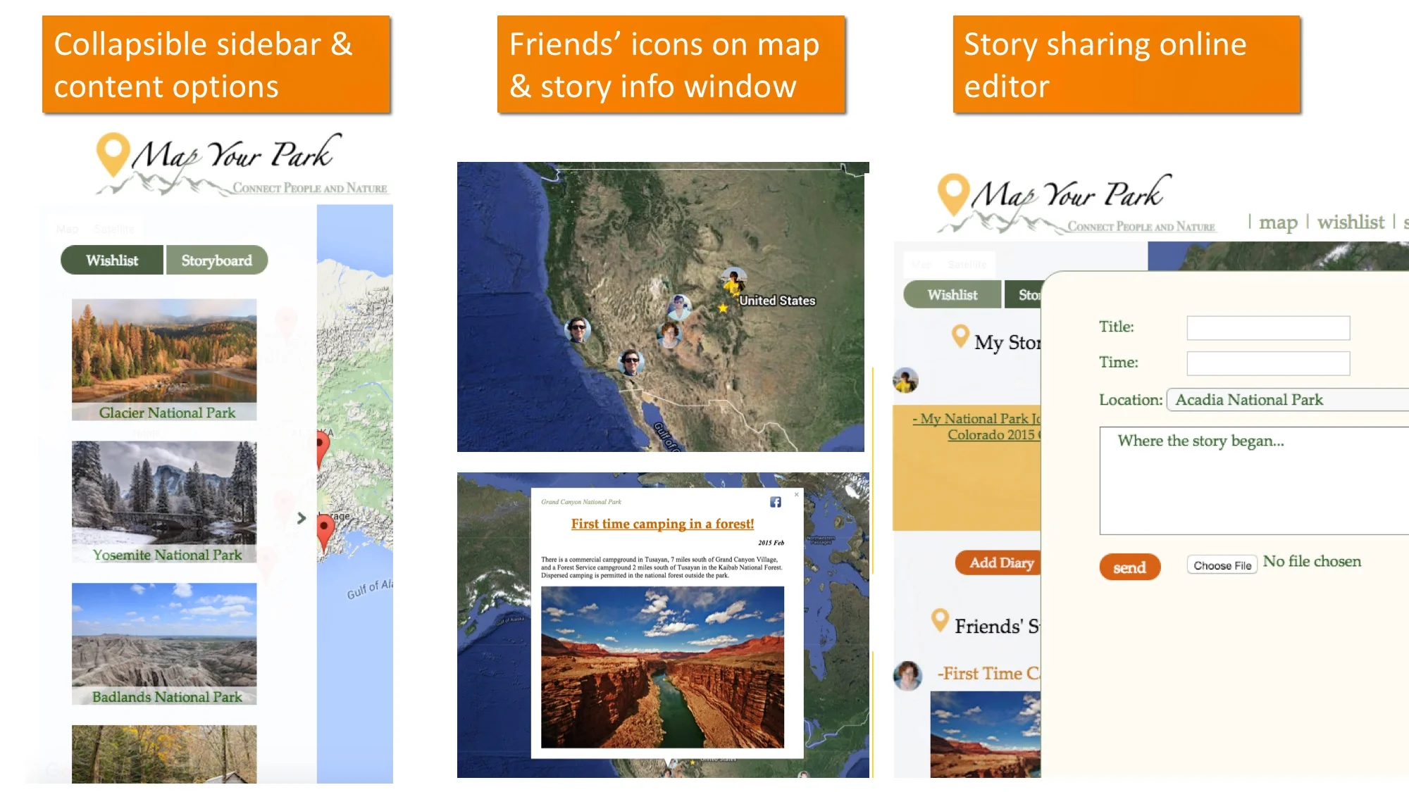
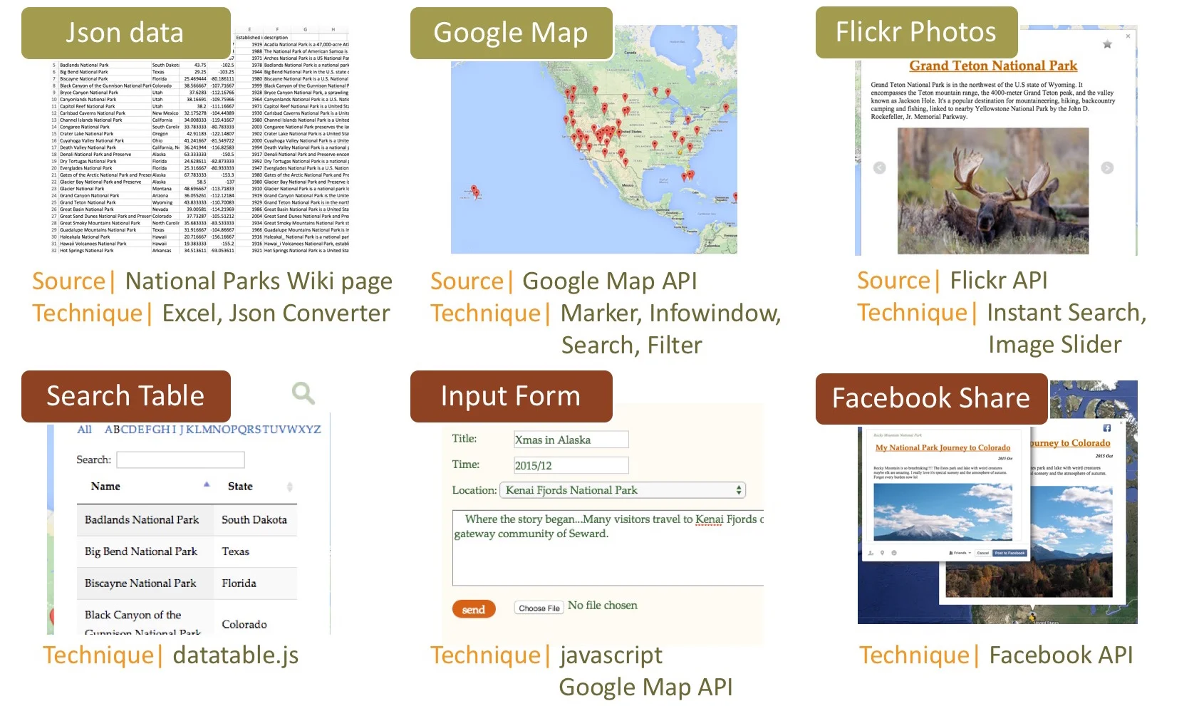
Based on other artifacts, I pulled out their featured descriptions, GPS data and Flickr photos searched by park's name to my design. Map Your Park has a national park map with search table, interactive map, information box that includes park description and Flickr photos, and other personalized functions like adding parks to wish list and write your own park stories.
Competitive Analysis
By identifying the essential features and information from other digital artifacts, I decided on what features Map Your Park would have and what unique value it could bring.
Implementation
I implemented the website using html5, css, javascript with other necessary API. The project was focusing on user experience and interactive design, so part of the functions are mockup only, including facebook sharing and add to wish list function. But the search table, google map, flickr and input form are completely developed.

User Testing
During the design process, I conducted user testing and gained feedback from 8 participants. They were asked to review the website and give out feedback while I observed their using of different functions. Some important changes on UX design were made after design critique and user testing.
Main Improvement
1. Make the map bigger - fullscreen
2. Change the font to a more formal font type
3. Add on some instructions and introduction
4. Checkbox filters apply immediately without clicking
Feedback from Users

Becky
Graphic Designer

Logan
Game Designer
Adding in the social feedback and mapping almost adds a game quality, which I could see being well received by people who frequent the parks. The addition of narrative only amplifies the beautiful imagery!
This project could be incredibly useful for a lot of people, whether they are tourists, or hikers, or campers. It shows standardized national data, as well as personal data from people who have gone to the parks themselves and given feedback.